On December 22, 2006 The Ursid shower showed an above normal peak as reported by visual observers, all-sky video observers, and by radio observers. The outburst was predicted in CBET 77. The West Kelowna camera was under an overcast and did not record any captures. The radio data however did record earth passing through the predicted Ursid filament.
Here is the original telegram announcing our findings:
The smoke and haze in Southeastern BC was a problem, but the Allsky Meteor Cam on the Cranbrook College of the Rockies roof still got a dozen bright Perseids or so on the 12-13th. Not 52 like Jeff Brower got on his AllSky meteor cam in Kelowna, by a long shot. This year was a bit better than 2013, although not as many bright fireballs. Below are the brightest ten meteors of the night, all shown on one frame, on the fisheye all-sky view.
I ended up going to the top of nearby Mt. Baker to get above the smoke. South of Cranbrook, just 26km on my tripmeter on a gravel logging road with lots of switchbacks, ending at some radio towers at 7,200 ft altitude. Even up there the horizons were shrouded in haze, and you could see blue haze in the headlights. I couldn’t see Sagittarius at all, no stars were visible below Aquilla. The dim red beacon lights on the radio tower tops weren’t too bright by the picnic table, so that’s where I ended up. I was the only person there, quiet and cool, about 11 deg C. Crickets singing, owls hooting and coyotes howling way off in the distance, motors and fans cutting on and off from the antennaes. Maybe a bat winged over. There are dozens of satellite dishes and radio towers around the hill crest there.
Mount Baker Radio Tower Site
I setup three Nikons and a colour video cam. Left them autoclicking for an hour until the main batteries died, then another hour until the spares died.
Perseid Meteor streaking through Cygnus Shot of a Perseid meteor streaking through Cygnus the Swan. Deneb is the bright blue-white star above.
Overhead the stars were clear and the sky dark with the Milky Way band glowing. Perseus, Pegasus and Auriga to the East over the Steeples were bright. It was great! The meteors were coming down left and right every fifteen seconds! Some bright ones leaving a glowing line that slowly faded. Mostly white, but some green tinged. Some sporatics that didn’t radiate from Perseus.
Short Green Meteor Trails in Perseus
That zigzag constellation above is Perseus, with two tiny green meteor streaks radiating from there, red at the ends. There is a fainter third meteor.
Sporatic Meteor through Cygnus
Above is a photo of a sporatic going through Cygnus the Swan. Deneb the tail at top, Alberio the beak at bottom. Milky way glow. Shots of Andromeda got nothing except the Andromeda galaxy.
I took these photos with a bunch of Nikon D100 DSLR cameras with Tamron 28mm f/2.5 lenses, and a Vivitar 28mm f/2.0 lens. Exposure times were 30 seconds at 3200 ISO using sunlight white balance. I found I needed at least a f/2.8 lens, since when I used a f/3.3 lens a fairly bright meteor only appeared as a faint streak across the photo.
The Internation Meteor Organization is having their 2015 Conference in Mistelbach, Austria. from August 27 (Thursday evening) until August 30. At that meeting, Bill Ward from Glascow, UK will be presenting this following paper on Video Spectroscopy. He writes:
One of the new observing programmes I’m working on is called “Towards a New Meteor Taxonomy” (under review). For the first time, as video spectroscopy has become so efficient (you’ll see on the poster I got over a hundred last year alone!) that large samples are now a viable prospect.
Shower meteors, by definition, should have similar properties but are there larger “families” within the sporadic population? I think I’ve taken the first step towards realizing this. I’ve found three spectra with almost identical properties. One from 2006 and two from this year.
Take a look at this: Fireball Spectra Discussion between Bill Ward, Martin Dubs, and Koji Maeda. About half way down are the three graphs.
Martin Dubs Meteor SpectraKoji Maeda”s Spectrum with Approx Element IDs
If this doesn’t persuade people that we’re into a new era of meteor observing I don’t know what will!!!
Video Meteor Spectroscopy Kilwinning Spectroscopic Survey for Meteors International Meteor Conference. Mistelbach, Austria. 27th-30th August 2015.
The KiSSMe project is an ongoing program to secure video meteor spectra on a routine basis year round. In the long term this may identify if there are any discernible compositional groupings amongst sporadic meteors/fireballs.
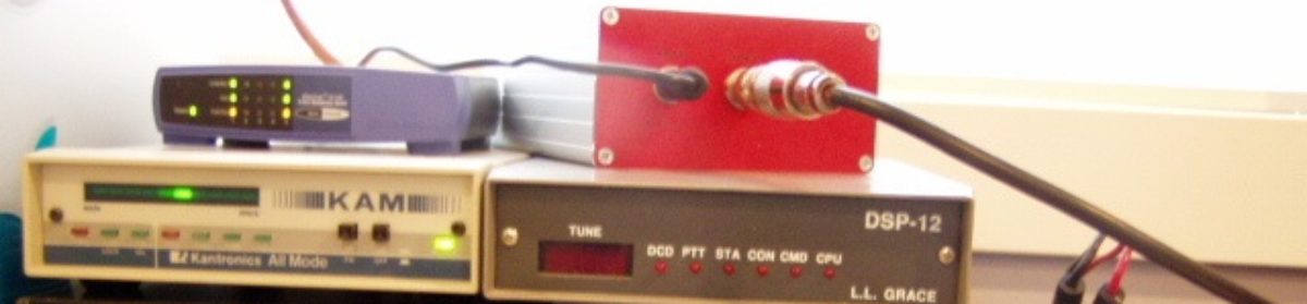
Currently three WATEC cameras are in use for spectroscopy (2 x 902H2 Ultimate and 1 x 910HX/RC). Each carries a 12mm f0.8 lens fitted with a 600 groove/mm transmission grating. The dispersion of this configuration is approximately 1.2nm/pixel. A further two WATEC cameras are used for general observing (1 x 902H2 Ultimate and 1 x 910HX/RC). Each is fitted with a 3.5 – 8mm f1 lens. Tests are currently underway with a QHY5II-M USB video camera to try and obtain HD images/spectra.
QuadrantidMeteorSpectra_BillWardPoster
From April 2014 to April 2015, 105 video meteor spectra were captured in 714 hours of observing. Examples of spectra generated by bright meteors are shown here.
Taurid Fireball Spectra from Poster
Working with members of the Network for Meteor Triangulation and Orbit Determination (NEMETODE) (1), simultaneous spectroscopic and orbit determination observations have been undertaken. This has resulted in the first such combined observation made from the UK.
The spectrum shows strong emission from magnesium, sodium, oxygen and iron. The meteor was determined to have had an orbital aphelion within the asteroid belt.
On June 18 Peter Spaans and I visited the site where the Canal Flats fireball hit, on the Middle White River. Here are some photos of the terrain there. For a closer look, right click on the photo and open it in a new tab
[Map_FireballArea_sm2.jpg] Map showing closeup of the strewn field ellipse. The centre of ellipse marked at “C”. We parked at “P” at a creek at 4.6km.
“Strewn Field” Distribution: Dr. Hildebrand assumes the meteor fragments are scattered in this elliptical area 3km wide by 5 km long, on a logged hillside on the Middle White River. Anything that hit on the East side of the river, would be on a narrow shelf of flat rock, with high rocky cliffs above and bluffs below. The heavier “three pieces” would likely travel to the far end of the ellipse across the river, with 1 and 2kg fragments near the centre, and lighter fragments not travelling as far, scattered along the Western edge.
Russell Ridge Wide View
Russell Ridge: [RussellPanMidBluff1_1537-38-39.JPG] photo of the Western Ridge from half way up the East river bluffs, looking Northwest towards Sinna Creek where it cuts through the notch in Russell Ridge and enters the Middle White River. Note all the dead trees from the forest fire of 2003. The meteor would have smoked in just over the ridge, hitting like shotgun pellets all along Sinna Creek and these bluffs; smacking into ten foot deep snow banks at a terminal velocity of about 200 to 300 km/h. (Initial velocity when it entered the atmosphere was slow for a meteor, around 15km/s, the average fireball enters at 20km/s. For comparison, the space station orbits at 8km/s).
Bluffs seen from river trail through trees
[BluffsWhiteREast_1534sm.JPG] Looking East to the Lancaster Bluffs along the river, from a spot on the old horse trail beside the river. This is where the bigger chunks of meteorite would have hit.
Bigger view of Lancaster Bluffs on the East, with Marconi Peak hidden behind them, from up on Russell ridge where we parked. [PanBluffsE28mm_1526-27-28.JPG] Wide view of the Lancaster East Bluffs
It’s pretty tangled at the meteor site. There are dead trees blown over from an old forest fire, and a dense crowd of 6 foot tall pine trees newly growing, and a river and four creeks running through it. But a little bit of paradise to hike in, once you’re down on an old horse trail paralleling the river. We gave up on the higher logging areas because of the crowds of small pine trees, and went down to the open river bluffs at the front third of the impact “ellipse” at 5,050 ft. More likelihood there of finding big chunks, and it’s not clogged with close-packed pine trees. The road to the Maiyuk Rec Site at 68km is washed out just before the Mid White bridge, so we crossed the river here over a fallen log.
Crossing a Log across the Middle White R
[LogBridgePete_1536sm.jpg] That’s Peter Spaans crossing the log in the photo. Pete used to work as lab instructor in the Physics Lab at the College back in the 1990s. I found about eight odd looking black rocks but none were attracted to a magnet. And found tasty red strawberries, elk tracks, bear scat. No mosquitoes. The trip was worth it just for the mountain scenery there. Solid limestone mountains rising with sheer slabs of snow tipped peaks. Birds singing, elk, deer, rabbits, porcupines and other wildlife.
Note that there’s a fellow working there for CanFor with a mulcher with caterpillar tracks, cutting four foot wide swathes into the densely planted pine trees for spacing purposes.
GETTING THERE:
Middle Fork Rec Site: Via main road, go to White Swan Lake, which is by Canal Flats, BC (near Invermere BC in the Rocky Mountain Range of the East Kootenay’s.). Follow the gravel logging road to the Middle Fork Rec Site just past Seeta Creek at KM66 on the White Middle fork of the White River Forest Service Road. There was a forest fire there in 2003, and it has been logged since, but the Middle Fork trail was cleared in Aug 2014. At 67km leave the main road and turn left on the Sinna Creek logging road 0.9 km past the Seeta Creek bridge. From there, go 3.1km to reach the edge of the ellipse. The centre of ellipse marked on the map as “C”. We parked at “P” at a creek at 4.6km; crossed it and walked down the next dry creek bed to the Lancaster bluffs.
Our Destination Ahead from KM60
View from 60km looking North, our destination in sight. [Pan_RussellJoffreMarconi_60km.jpg] That teepee mountain on the centre left is Russell Peak. Snow and glacier covered Mt. Joffre and Mt. Nivelle at centre, and Mt. Marconi at right centre, behind Lancaster bluffs.
WHAT TO LOOK FOR: Carbonaceous Chondrites: comprise only about 2 percent of meteorites known to have fallen to Earth, are typically difficult to recover because they easily break down during entry into Earth’s atmosphere and during weathering on the ground. Look for black or dark grey rocks that a magnet will stick to. The surface may have a thin grayish fusion crust (a thin melted layer one or two millimetres thick) and scattered thumb sized hollows (worn away by atmospheric friction ablation, called regmaglypts). Although some rarer meteorites like the Tagish Lake meteorite looked like charcoal briquettes.
Ignore layered sedimentary rocks (shale, limestone, dolomite) since these require an ocean to form, and this wouldn’t be found on an asteroid in outer space. Also, if it has holes or bubbles inside (like pumice) that was likely from lava flows (basalt-magma) cooled with trapped volcanic gases, on Earth (although there are rare exceptions: a large asteroid like Vesta had volcanoes). Also, ignore rocks containing quartz or calcite, since they form in high pressure, hot watery solutions.
Magnets: Since a lot of carbonaceous chondrite types (CH, CI, CM, CB) contain iron oxides like magnetite, and some metal rich ones contain nickel-iron chondrules, a rare-earth magnet should stick to most. Dr. Hildebrand says: “Even the hydrated carbonaceous chondrite meteorites would stick to a magnet; something like a CV4 like Allende has the least ferro magnetic phases and might not stick, but that lithology looks v. much like meteorites and I would have guessed that this rock was weaker than CV (not that I really know). Only thing to add would be to keep an eye out for a pile of debris rather than just a solid stone – the hydrated lithologies would probably have started to break up by now.”
Three types of carbonaceous chondrites
Photo: from Wikipedia showing some carbonaceous chondrites. From left to right: type CV4: Allende, C2: Tagish Lake (in sample bag on white paper) and CM: Murchison. Chondrite means that inside the rock are silicate chunks ranging in size from 0.3mm to 10mm, surrounded by a fine-grain black rock matrix. The chunks are usually olivine (a magnesium iron silicate common on Earth but quickly weathered) or the chunks can be nickel-iron metal. The black rock matrix is made of hydrous phyllosilicates similar to terrestrial clays, sulfides, and oxidized iron in the form of magnetite. Many contain high percentages (3% to 22%) of water, as well as organic compounds (like bitumen). However there are many types and they are complex and fairly challenging to describe, so for more detail, see: http://www.meteorite.fr/en/classification/carbonaceous.htm, and http://Wikipedia.org/wiki/carbonaceous_chondrite
Value: If a hiker finds a piece, it could be worth a lot of bucks per gram or it may be disappointing. Common iron meteors are only $.50/gram to $5/gram, rarer stony meteorites $2 to $20/gram, and really rare ones $100 or $1000/gram or more, depending if they have embedded gems or if they’re from Mars or the Moon. And some meteors are dense and heavy, so they go a long way. For example, back in 2000, the rare carbonaceous chondrite meteor that landed on frozen Tagish Lake on the B.C.-Yukon border brought Jim Brook, the lodge owner who found it an estimated $850,000. The University of Alberta, with Canada’s second-largest meteorite collection, bought most of the meteorite. For sample meteorite pricing, see http://www.meteorlab.com/METEORLAB2001dev/offering21o.htm The Washington University in St. Louis has a great webpage showing all sorts of meteorites at http://meteorites.wustl.edu/id/metal2.htm.
If you do find a possible meteorite, send a photo to Dr. Hildebrand at the University of Alberta in Calgary. Note that American Meteor hunters have to report to the Canadian Customs, Canada has export restrictions on them.
Meteorite ID Flow Chart
[meteorite_flow_chart.gif] Above is a flow chart guide designed by Deborah Guedes in Brazil to help identify a meteorite. http://www.lpi.usra.edu/meetings/metsoc2010/pdf/5357.pdf “Regmaglypts” are those worn-away thumb sized hollows in the surface.
Rick Nowell Astronomy Lab Tech College of the Rockies Cranbrook, BC
The Eta Aquarid Meteor Shower should peak Monday night, the 5th of May at 07:00 Universal Time (or midnight Mountain Time, 11pm Pacific Time), but the best viewing times (due to the Moon and a low Eastern radiant) will a few hours before dawn Tuesday morning, around 4am to 5am.
At the peak, up to 55 meteors could be seen each hour.They’re pretty fast, at 66km/second, often bright with very long paths, and leave persistent glowing trails.
The source of the meteors is debris from Halley’s comet.The Comet’s orbital path contains dust particles and ice (thinned out in spots by Jupiter).The Earth crosses the orbital path of Halley’s Comet twice each year.In May we see it as the Eta Aquarid meteor shower and in October the Orionids.
The Eta Aquarids should be best seen early Tuesday morning. The Moon will have set by then, so it will be seen under a dark sky.The radiant is low in the Eastern sky, in Aquarius, which rises around 4am.So half the meteors will be unseen below the horizon.
LOCATION: Dr. Alan Hildebrand sent out the location marked on a map as an ellipse. From a topographical map NTS82J the centre of that ellipse is: 50° 21’N, 115° 13′ W (50.385, -115.217), and from GoogleMaps that is 50° 23′, 115° 13′ W, 550 ft down the hill. Lincoln Hanton and Alan Hildebrand assume the meteor fragments are scattered in an ellipse 3km wide by 5 km long, along this logged hillside. This is near Sinna Creek, between Russell Peak and Marconi Peak. Just a few kilometres from the Height of the Rockies Provincial Park boundary. For a quick look, cut and paste this into the Google Maps Search line: 50.385N 115.2145W
Strewnfield Fragment Distribution: Because of this scenic and rugged area, the centre of the ellipse would be on a logged hillside on the West side of the Middle White River gorge. Although some would be down in the gorge. Anything that hit across on the East side of the gorge, would be on a narrow shelf of flat rock, with high rocky cliffs above and below. It is expected that the heavier “three pieces” would travel to the far end of the ellipse across the river, and 2kg fragments near the centre, with lighter fragments not travelling as far, scattered along the Western edge.
Dr. Hildebrand has already scouted the area twice in a light aircraft this spring. Other people have been there on the ground, and they report that at the ellipse the logged area has been replanted with pine trees, which have grown to 6 foot tall. They also mention the bridge at 68km was out.
Middle Fork Rec Site: Via main road, go to the Middle Fork Rec Site near Seeta Creek at KM66 on the White Middle fork of the White River Forest Service Road. There was a forest fire there in 2003, and it has been logged since, but the Middle Fork trail was cleared in Aug 2014. Leave the main road and turn left on the Sinna Creek logging road 0.9km past the Seeta Creek bridge. After following the river bank for 3.2km, turn left up the hill. At 3.7km turn left again, and continue until 4.9 km. You are at ground zero, 50.385N 115.2145W
Maiyuk Rec Site: Note that just 2km further up the main road is the Maiyuk Rec Site at KM68, with horse corrals, firepits and outhouse. If you can get there, that is. Reports are that the Middle White River road at 67.5KM is still washed out just before the bridge, and won’t be fixed until Sept 2015. Some people have been using a ford across the river there, going through 18 inch deep water with a solid gravel bottom.
Above is a road map– right click on it and open it in a new tab to see it full size.
SPRING FLOOD WASHOUT AT KM59:Now that the river is flooding with snow melt, we’re getting a washout on the Middle White Road, at a culvert just past the bridge at the Mt. Forsyth Rec Site at KM59. GPS: 50.2780N 115.2000W 1390m (that’s 50d 16′ 41″, -115d 12′ 00″) Water is about knee deep, with a fast current. Below the surface are soft muddy ruts. The Middle White R. is overflowing it’s banks and cutting across a loop, running from right to left in the photo. The concrete/steel bridge 50 feet back over the Middle White is fine. Water is everywhere through the trees. No place to cross on foot, without getting wet.
Washout at Forsyth Rec Site
LOWER NORTH FORK Route: The map shows another way around. We backtracked back across the bridge at KM43 and tried an alternate route on the Lower North White Road. Do you notice anything odd about the bridge in this photo?
North Fork White River Lower Bridge
Yep, one end is missing. Presumably this washed out in the big 2013 flood. Note the six ten-foot long planks placed at the end for ATVs to cross. So it would be possible to take motorcycles or ATVs past there. Assuming there aren’t trees down and more washouts further along this rugged road. (This bridge is at GPS 50.232N 115.265W).
3D Anaglyph of Mid White R. Gorge
If you have 3D goggles handy (the NASA standard type red/cyan anaglyph ones) then take a peek at this awesome impact area 3D photo. Those are rugged high mountains and deep river gorges there. Russell peak range is like the prow of a big battleship on the left. Deep gorge in middle. Sinna Creek running through a gouge in the ridge. That rectangular feature to the centre right is a towering T-shape mountain. These stereoscopic photo pairs were photographed in 2005.
The BC Meteor network stations routinely upload our meteor videos to a central North American gathering site, where they are displayed for the public for about a month before being archived.
Previously that was the New Mexico State University Allsky Camera site in Las Cruces, NM. (Klipsch School of Electrical and Computer Engineering) at http://skysentinel.nmsu.edu/allsky/clusters There they store the videos sorted by regions (which they call clusters and nodes) and match events common to multiple stations. However last year their grant ran out from the Sandia National Laboratory and the National Nuclear Security Administration of the Dept. Of Energy. They have been doing it for free until a new site takes over.
The new site is run by Space Coast Intelligent Solutions (SCIS) Melbourne, FL at http://goskysentinel.com/clusters (in transition from NMSU). The site is already working, and shows cluster events seen from multiple cameras, and that will grow as more cameras transition. The NMSU server will be shut down once all the cameras that were online there have been transitioned to goskysentinel.com.
The Eta Aquariid Meteor Shower should peak Tuesday morning, the 6th of May at 07:00 Universal Time (or midnight Pacific Daylight Savings Time, or 1am Mountain Saving Time), but the best viewing times (due to the Moon and a low Eastern radiant) will a few hours before dawn Tuesday morning, around 4am to 5am.
At the peak, up to 55 meteors could be seen each hour. They’re pretty fast, at 66km/second, often bright with very long paths, and leave persistent glowing trails.
The source of the meteors is debris from Halley’s Comet. The Comet’s orbital path contains dust particles and ice (thinned out in spots by Jupiter). The Earth crosses Halley’s orbital path twice each year. In May we see it as the Eta Aquariid meteor shower and in October the Orionids.
The Eta Aquariids will be best seen early Tuesday morning. The Moon will have set by then, so it will be seen under a dark sky. The radiant is low in the Eastern sky, in Aquarius, which rises around 4am. So over half of the meteors will be unseen below the horizon.
If you miss the peak, they will continue to fall all week, slowly tapering off, with above 30 meteors/hr lasting from May 3 to Saturday May 10 2014.
For more information, see the International Meteor Organization Site at http://www.imo.net/calendar/2014#eta
Picture taken by Brett Abernethy from Johnson Lake near Banff, about 95 km North of Canal Flats (at 51.2138°N, -115.5013°W, 1,480m ). Looking due South, Brett took the photo on Dec 20, 2014 at 12:20am, while setup to photograph the Aurora Borealis. Brett says it fell slowly, flaring just like a welding arc, bright enough to light up the entire landscape, and 2.5 seconds later ended by exploding into three pieces, cooling to an orange colour at around 30km high.
Canal Flats Fireball as Seen From Cranbrook
The same fireball as seen from Cranbrook, about 90km South of Canal Flats, viewed through the thin clouds, measuring as bright as the full Moon, magnitude about -12. This is an Animated GIF which plays 11 frames of the meteor if viewed on a website, or webmail. Taken from the College of the Rockies, 49.518 °N 115.744 °W Elevation 940m.
CanalFlatsFireball_RAO_AllSky_Camera_Calgary
The Rothney Astrophysical Observatory at University of Calgary also imaged it at 00:23:53 at Lat 50.868039 °N, Long 114.291142 °W, 1,270m. A nice colour photo, it’s a one minute composite.
With three ground sites having a good fix on it, Lincoln Hanton and Dr. Alan Hildebrand determined the impact site pretty accurately at 50° 21’N, 115° 13’W.
Map of Canal Flats Impact Area3D Aerial Photo of Impact Area
If you have standard red/cyan 3D glasses, you can view the valley near Marconi Peak where the meteor impacted and see the high mountain ridges East and West. These are old aerial photos from 1981.
Preliminary results from Belarus-Ukraine observers :
are consistent with the hypothesis that earth did pass through Comet ISON’s long tail in January 7-23, and that this caused a significant increase in meteor counts as detected by observers in Ukraine and Belarus.
Call to Action : If any others can summarize their own results this would be very helpful.
Minsk Team write :
Уважаемые коллеги Александр и Bill !
Остаётся просмотреть снимки на 2,5 олл-скай камерах 🙂
11 – 13 января – явно вырисовывается радиант “спорадических” метеоров из региона Leo,LMi, UMa, UMi, Cam, Lyn, Cnc.
Мы просмотрели снимки олл-скай камер в интервале времени 10 – 17 января 2014 года. Иван М. Сергей показал график радионаблюдений метеорного фона за январь 2014 – там хорошо просматривается повышенная метеорная активность 08 – 24 января 2014. Прилагаю графики радионаблюдений за январь 2012 и январь 2013
Может нам поднять снимки и просмотреть ещё раз в интервале 06 – 26 января 2014 ?
Bill, может у Вас кто-нибудь тоже проведёт подобную работу – просмотры снимков олл-скай камер и радионаблюдения метеорного фона
Иван Брюханов Анастасия Кулаковская, Валентин Таболич, Анастасия Таболич. Минск
ENGL
Dear colleagues, Alexander and Bill!
It remains to view images on 2.5 all-sky cameras 🙂
January 11-13 – clearly emerges radiant ” sporadic ” meteors from the region Leo, LMi, UMa, UMi, Cam, Lyn, Cnc.
We viewed pictures of all- sky cameras in the time interval 10-17 January 2014. Ivan Sergei M. schedule radio observations showed meteor background for January 2014 – there is clearly visible meteor activity increased 08 – January 24, 2014 . Attached chart for radio observations in January 2012 and January 2013
Maybe we should raise the pictures and see again in the range of 06 – 26 January 2014 ?
Bill, can you hold someone too similar work – views pictures all- sky cameras and radio observations of the meteor background?
Ivan Bryukhanov Anastasia Kulakovskaya, Valentin Tabolich, Anastasia Tabolich. Minsk