
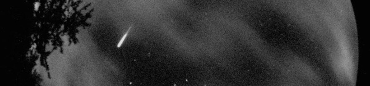

Picture taken by Brett Abernethy from Johnson Lake near Banff, about 95 km North of Canal Flats (at 51.2138°N, -115.5013°W, 1,480m ). Looking due South, Brett took the photo on Dec 20, 2014 at 12:20am, while setup to photograph the Aurora Borealis. Brett says it fell slowly, flaring just like a welding arc, bright enough to light up the entire landscape, and 2.5 seconds later ended by exploding into three pieces, cooling to an orange colour at around 30km high.

The same fireball as seen from Cranbrook, about 90km South of Canal Flats, viewed through the thin clouds, measuring as bright as the full Moon, magnitude about -12. This is an Animated GIF which plays 11 frames of the meteor if viewed on a website, or webmail. Taken from the College of the Rockies, 49.518 °N 115.744 °W Elevation 940m.

The Rothney Astrophysical Observatory at University of Calgary also imaged it at 00:23:53 at Lat 50.868039 °N, Long 114.291142 °W, 1,270m. A nice colour photo, it’s a one minute composite.
With three ground sites having a good fix on it, Lincoln Hanton and Dr. Alan Hildebrand determined the impact site pretty accurately at 50° 21’N, 115° 13’W.


If you have standard red/cyan 3D glasses, you can view the valley near Marconi Peak where the meteor impacted and see the high mountain ridges East and West. These are old aerial photos from 1981.
More info to add yet